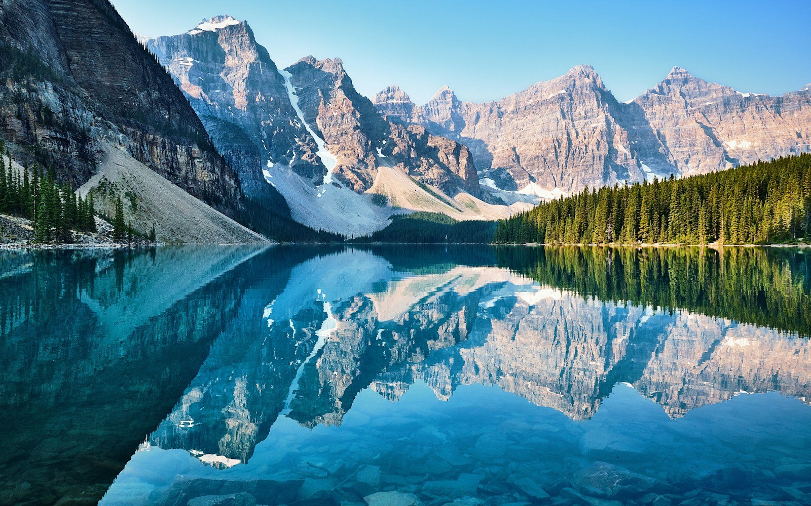
The Icefields Parkway (Highway 93 North) spans 232 kilometers (144 miles) through the heart of the Canadian Rocky Mountain Parks UNESCO World Heritage site, uniting Lake Louise in Banff National Park with the alpine town of Jasper. Crossing two high mountain passes (Bow Pass at 2,067 m and Sunwapta Pass at 2,030 m), the route borders over 100 visible glaciers, turquoise rock-flour glacial lakes, and sheer limestone massifs exceeding 3,400 meters.
Trip Briefing & Field Notes
Highway 93 North (Lake Louise to Jasper)
3 to 5 Days
June to September (Dry Summer Conditions)
Wilderness Stargazer Geodesic Suite
Leaving the forested shoreline of Lake Louise behind and turning northward onto Highway 93 North, the scale of the landscape widens with startling suddenness. The highway does not skirt the Canadian Rockies; it cuts directly through their continental core. Hanging glaciers cling precariously to sheer vertical limestone walls, braided meltwater rivers rush over pale gravel bars, and grizzly bears forage along wildflower meadows beneath peaks that have stood carved by ancient ice for millennia.
Constructed during the Great Depression by crews of unemployed men equipped only with picks, shovels, and horse-drawn scrapers, the Icefields Parkway opened in 1940 to celebrate wilderness motoring. Because commercial truck transport is strictly barred, the corridor remains an unhurried mountain sanctuary. Before embarking from Lake Louise or Jasper, motorists must obtain a national park pass and inspect road condition bulletins from Parks Canada Jasper National Park Field Unit.
Glacial Hydrology: From Peyto Lake to the Columbia Icefield
The optical colors of the lakes along Highway 93 North seem almost surreal to first-time visitors. At Mile 40 (Bow Pass), a short uphill walking trail leads to the iconic Peyto Lake Overlook at 2,067 meters. The lake below glows with an intense, opaque turquoise hue shaped remarkably like the profile of a wolf’s head.
This vibrant coloration is produced by glacial flour (silt): fine particles of rock ground down by the grinding action of the Peyto Glacier upstream. Suspended in meltwater, these microscopic particles scatter sunlight, absorbing darker colors while reflecting bright green and turquoise wavelengths.

The Columbia Icefield: Continental Hydrological Apex
At kilometer 127, the highway breaches Sunwapta Pass (2,030 meters) and enters Jasper National Park, bringing motorists face-to-face with the immense Columbia Icefield. Covering 325 square kilometers, this is the largest icefield in the Rocky Mountains south of the Arctic Circle.
What makes this site globally extraordinary is its status as a triple continental divide. Meltwater flowing from Snow Dome (3,456 meters) drains into three distinct oceans: northward to the Arctic Ocean via the Mackenzie River, eastward to the Atlantic (Hudson Bay) via the Saskatchewan River, and westward to the Pacific Ocean via the Columbia River system.
Visitors can walk up to the toe of the receding Athabasca Glacier, where wooden date markers show how dramatically the ice sheet has melted backwards over the past century. To verify winter traction requirements or summer road construction delays, check the province-wide updates published by Alberta 511 Real-Time Road Reports.
Field Advisory
Midway Fuel Reality on Highway 93N
Icefields Parkway Waypoint & Elevation Milestones Table
The following logistical dossier details essential stops, elevations, and trail connections along the north-bound route:
| Waypoint Station | Kilometer Post | Elevation | Landmark Feature & Activities |
|---|---|---|---|
| Lake Louise Junction | km 0 | 1,661 m / 5,449 ft | Southern gateway; full services, Parks Canada visitor center |
| Herbert Lake | km 3 | 1,620 m / 5,315 ft | Glassy morning reflection of Mount Temple and Waputik Range |
| Bow Lake & Crowfoot Glacier | km 34 | 1,920 m / 6,299 ft | Historic Num-Ti-Jah Lodge, Bow Glacier Falls trailhead |
| Bow Pass & Peyto Lake | km 40 | 2,067 m / 6,781 ft | Highest pass on parkway; short paved walk to wolf-head overlook |
| Saskatchewan River Crossing | km 76 | 1,410 m / 4,626 ft | Three river junction (Howse, Mistaya, North Sask); seasonal fuel |
| Columbia Icefield Centre | km 127 | 1,980 m / 6,496 ft | Athabasca Glacier access, Glacier Skywalk, interpretive exhibits |
| Sunwapta Falls | km 176 | 1,350 m / 4,429 ft | Thundering class-V canyon waterfall carving deep limestone gorge |
| Athabasca Falls | km 200 | 1,180 m / 3,871 ft | Powerful glacial gorge, potholes carved by river whirlpools |
| Jasper Townsite | km 232 | 1,062 m / 3,484 ft | Northern terminus; dark sky preserve, dining, train station |
Canyon Waterfalls: Sunwapta & Athabasca
North of the Columbia Icefield, the highway follows the Sunwapta and Athabasca river valleys toward Jasper, punctuated by two of Canada’s most powerful waterfalls. At Sunwapta Falls (km 176), water plunging around an isolated forested island drops into a deep, swirling canyon slot.
Twenty-four kilometers further north stands Athabasca Falls. While not exceptionally high (23 meters), the sheer volume of water forced through a narrow quartzite gorge creates thunderous vibrations felt through the surrounding stone railings. Wandering the network of interpretive canyon trails reveals historic river potholes carved out when water levels were ten times higher during the retreat of the last ice age.

Glacier View Lodge Geodesic Suites
CAD $395 / night
Wildlife Safety & Wilderness Preservation
The Icefields Parkway corridor traverses critical wildlife habitat for grizzly bears, black bears, moose, bighorn sheep, mountain goats, and endangered woodland caribou:
- Bear Jam Ethics: If you spot a bear along the roadway, do not exit your vehicle under any circumstances. Pull completely onto the gravel shoulder, keep your vehicle running, snap photographs from your closed window, and move on after two minutes to prevent causing dangerous traffic snarls.
- Keep Your Distance: Maintain at least 100 meters of separation from bears and cougars, and at least 30 meters from elk, moose, and bighorn sheep. Elk during the autumn rut and bighorn rams during winter head-butting season can be extremely aggressive.
- Carry Bear Spray on Day Hikes: Even on short walks to Peyto Lake or Sunwapta Falls, carry certified EPA-approved bear spray on your hip or chest harness, not packed away inside a backpack.
For comprehensive wildlife safety guidelines, summer seasonal hotel bookings in Jasper, and guided interpretive backcountry tours, consult the official planning resources provided by Travel Alberta Tourism Authority. The Icefields Parkway remains one of the world’s truly sacred mountain journeys: a day spent in quiet communion with ancient ice, colossal stone, and boundless sky.
Continue planning your journey with our companion mountain pass dossiers, geodesic lodging inspections, and packing blueprints:
-
Milford Road in Fiordland →
Driving New Zealand’s sheer granite valleys into Milford Sound. -
Blue Ridge Parkway Guide →
Milepost-by-milepost Appalachian ridgeline overlooks and viaducts. -
Mountain Road Trip Packing Blueprint →
Comprehensive mountain road trip packing and emergency preparedness.