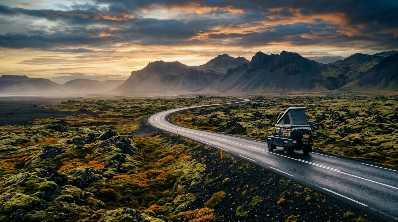
Iceland’s Ring Road (Route 1 / Hringvegur) spans 1,322 kilometers (821 miles) completely encircling the subarctic island nation. Requiring 8 to 10 days for a responsible overland circuit, Route 1 connects black volcanic sands, calving glacial lagoons, cascading amphitheater waterfalls, and remote eastern fjord passes with direct access to off-grid geothermal glass dome sanctuaries.
Trip Briefing & Field Notes
Route 1 (Hringvegur National Beltway)
3 to 5 Days
May to September (Paved Route 1)
Wilderness Stargazer Geodesic Suite
Stepping off the North Atlantic ferry or collecting keys at Keflavik, the Icelandic wind delivers an immediate sensory shock: crisp, clean maritime air charged with sulfur minerals and arctic sea spray. Route 1, affectionately known as the Hringvegur, is not merely a highway; it is the physical circulatory system of an island forged by catastrophic volcanism and colossal glacial ice caps.
Overland travel along Route 1 represents one of the premier driving expeditions on Earth. Because the beltway remains largely two lanes without dividing barriers, it forces motorists into an unhurried, rhythmic pace. You encounter roaring glacial rivers draining the massive Vatnajokull ice cap, stark black basalt columns carved by maritime breakers, and steaming solfatara fields that smell of prehistoric creation. For daily road clearance conditions, single-lane bridge advisories, and sudden gravel transition warnings, drivers must monitor live updates from Vegagerdin: Icelandic Road and Coastal Administration.
Geographic Architecture of the Hringvegur
Completed in 1974 when the formidable Skeidararsandur glacial outwash plain was finally bridged, Route 1 connects Reykjavik with the regional hubs of Vik, Hofn, Egilsstadir, and Akureyri. While the roadway is now fully paved along its entire primary corridor, its conditions vary dramatically by sector. Drivers must navigate sudden ocean gusts exceeding 35 knots, high mountain gravel passes in the East Fjords, and unpredictable subarctic weather swings that can transform summer drizzle into driving sleet within forty minutes.
Successful navigation hinges on understanding wind vectors and subarctic storm systems. Before departing each morning, motorists should cross-reference satellite wind charts via the Icelandic Meteorological Office to anticipate localized sandstorm warnings along the southern outwash plains or gale-force pass winds across the Jokuldalur plateau.
Leg 1: The Golden Circle & South Coast Waterfall Corridor
Departing Reykjavik eastward across the Hellisheidi geothermal plateau, the roadway descends into the lush agricultural lowlands of Selfoss before tracing the base of the Eyjafjallajokull and Myrdalsjokull volcanic massifs. This southern ribbon is defined by colossal vertical cataracts.
At kilometer 128, Seljalandsfoss plunges 60 meters over a recessed basalt amphitheater, allowing drivers to walk behind the thundering water veil into a mist-filled cavern. Thirty kilometers further east stands Skogafoss, a monolithic wall of water 25 meters wide crashing onto black volcanic gravel. Climbing the 527 timber steps alongside the eastern cliff unlocks the start of the celebrated Fimmvorduhals mountain pass trail.
Past Skogar, the route approaches the dramatic black sand promontory of Vik i Myrdal. Reynisfjara beach reveals towering basalt sea stacks (Reynisdrangar) rising like petrified sentinels from roaring Atlantic swells. Note that sneaker waves along this coast represent severe hazards: never turn your back on the shoreline, and heed all automated digital beach safety warning beacons.
Field Advisory
Southern Sandstorm & Door Damage Protocol
Leg 2: Glacial Lagoons & The Vast Skeidararsandur Plains
East of Kirkjubaejarklaustur, the roadway traverses the immense Eldhraun lava field, a moss-cushioned basalt desert created during the cataclysmic 1783 Laki fissure eruption. The silence here is absolute; dense woolly fringe moss muffles footsteps and engine hum alike.
Emerging onto the Skeidararsandur, motorists cross expansive single-lane steel bridges spanning braided glacial rivers that carry meltwater from Vatnajokull, Europe’s largest ice cap by volume. At kilometer 370 lies Jokulsarlon Glacier Lagoon. Here, ancient blue icebergs break away from the Breidamerkurjokull glacier tongue and drift silently through a deep tidal channel toward the Atlantic Ocean. Across Route 1, the icebergs wash ashore on volcanic gravel at the famous Diamond Beach, glistening like sculpted crystal jewels against pitch-black sands.

Route 1 Waypoint Elevation & Milestones Dossier
Pacing your overland journey requires balancing driving hours with weather windows and scenic explorations. The following reference table outlines key waypoints, driving legs, and surface characteristics along the primary 10-day circuit:
| Route 1 Sector | Distance Leg | Key Natural Landmark | Road Surface & Character |
|---|---|---|---|
| Reykjavik to Vik | 187 km / 116 mi | Seljalandsfoss, Skogafoss, Reynisfjara | Paved two-lane highway, heavy summer traffic |
| Vik to Hofn | 272 km / 169 mi | Eldhraun lava field, Jokulsarlon lagoon | Long straight coastal flats, multiple single-lane bridges |
| Hofn to Egilsstadir | 256 km / 159 mi | East Fjords, Stokksnes, Oxi mountain pass | Dramatic coastal cliff contouring, sharp gravel switchbacks |
| Egilsstadir to Myvatn | 175 km / 109 mi | Dettifoss falls, Hverir boiling mudpots | High-plateau desert tundra, sub-zero morning frost |
| Myvatn to Akureyri | 99 km / 62 mi | Godafoss falls, Eyjafjordur fjord | Smooth mountain pass paving, Vaðlaheidargong tunnel |
| Akureyri to Borgarnes | 312 km / 194 mi | Hvitserkur basalt sea arch, Grabrok crater | Rolling agricultural valleys, coastal headland winds |
| Borgarnes to Reykjavik | 76 km / 47 mi | Hvalfjordur subsea tunnel, Mount Esja | Modern high-speed multi-lane divided expressway |
Leg 3: The Rugged East Fjords & Remote Fishing Havens
Past Hofn, the highway turns northward into the East Fjords (Austfirdir), the geologically oldest sector of Iceland. Here, 16-million-year-old basalt strata stand stacked like colossal tiered amphitheaters, dipping directly into sheltered North Atlantic bays.
Driving the East Fjords demands patience and respect. Route 1 loops around the perimeter of sweeping peninsulas, offering close encounters with coastal reindeer herds and nesting sea birds. While the high-elevation gravel shortcut across the Oxi pass (Route 939) shaves 60 kilometers off the journey, it features steep 17-percent grades and frequent thick mountain fog; drivers in two-wheel-drive sedans should remain on paved Route 1 along the coast via Breiddalsvik and Stodvarfjordur. For seasonal cultural exhibits and regional history, visit the travel resources provided by Visit Iceland Official Tourism Board.
Torfa Retreat Geodesic Aurora Suites
€340 / night
Leg 4: Lake Myvatn Volcanism & The North Coast
Climbing out of the East Fjords onto the desolate Jokuldalsheidi plateau, the terrain shifts into a barren volcanic moonscape. This was the exact terrain where NASA Apollo astronauts trained in the late 1960s to master lunar geology sampling.
Approaching Lake Myvatn, travellers encounter Hverir, a boiling geothermal field of sulfur bubbling mud pots, smoking steam vents, and ochre-streaked mineral crusts. Nearby, Dimmuborgir presents a labyrinth of collapsed volcanic lava tubes resembling a ruined gothic fortress. Before entering Akureyri, the charming capital of northern Iceland, take time to visit Godafoss, the “Waterfall of the Gods”, where legendary chieftain Thorgeir cast his pagan Norse idols into the rushing turquoise falls upon Iceland’s historic conversion to Christianity in the year 1000.
Essential Winter & Shoulder Season Driving Guidelines
Traversing Route 1 during the shoulder months (September to October and April to May) or winter requires specialized preparedness:
- Studded Winter Tires: Icelandic law requires dedicated winter tires from November 1 to April 15. For Ring Road circuits outside summer, studded winter tires provide essential grip on black ice.
- Single-Lane Bridges: Over 30 bridges on Route 1 remain single-lane. The vehicle closest to the bridge entrance maintains legal right-of-way. Slow down to 30 km/h upon approach and flash headlights to signal intent.
- Emergency Communication: Download the SafeTravel Iceland app and log your travel itinerary before embarking on remote segments. Cellular coverage along Route 1 is generally robust, but high passes can experience temporary dead zones during blizzards.
The complete circuit of Route 1 is a transformative overland pilgrimage. It teaches drivers to honor nature’s rhythms, surrender rigid timetables to prevailing wind gusts, and embrace the sublime stillness of high-latitude wilderness.
Continue planning your journey with our companion mountain pass dossiers, geodesic lodging inspections, and packing blueprints:
-
Nordic Aurora Glass Domes →
Finnish Lapland winter stargazing and sub-zero geodesic living. -
Scotland’s North Coast 500 →
Pacing, single-track passing places, and North Atlantic coastal castles. -
Mountain Road Trip Packing Blueprint →
Essential cold-weather layering and emergency vehicle readiness.