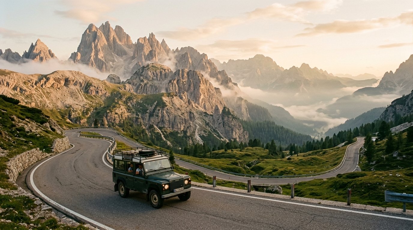
The Great Dolomites Road (Grande Strada delle Dolomiti / SS241 and SR48) stretches 110 kilometers (68 miles) from Bolzano to Cortina d’Ampezzo. Crossing Passo Costalunga, Passo Pordoi (2,239 m), and Passo Falzarego, the journey requires 4 to 6 hours of unhurried wheel time across 60+ engineered hairpins with direct panoramas of the Rosengarten, Sella, and Marmolada massifs.
Trip Briefing & Field Notes
SS241 & SR48 (Bolzano to Cortina d'Ampezzo)
3 to 5 Days
Late May to Mid-October
Wilderness Stargazer Geodesic Suite
Leaving the humid orchard terraces of the Adige Valley behind, the asphalt tilts upward almost immediately upon entering the narrow gorge of the Eggental. The granite walls give way to warm, pale dolomite limestone that catches the early morning sun like powdered ivory. Opened officially in 1909 to unite the high communities of the Austro-Hungarian Tyrol with the Veneto, the Great Dolomites Road remains one of the world’s crowning achievements in alpine road engineering.
Driving this corridor is an exercise in scale. Rather than tunneling through mountain masses as modern expressways do, the Grande Strada embraces the terrain, contouring along sheer limestone precipices, climbing through subalpine larch forests, and crossing high mountain cols that test vehicle balance and driver attention. For slow travellers, the route offers unmatched access to the pale mountain heritage protected under the UNESCO Dolomites World Heritage Foundation.
Historical Lineage of the Grande Strada delle Dolomiti
Before the road was surveyed, trans-Dolomite transit was confined to rugged mule tracks and seasonal trade passes. Pioneer mountaineers Theodor Christomannos and Albert Wachtler recognized that uniting Bolzano, the Val di Fassa, and Cortina d’Ampezzo would permanently unlock the cultural heart of the Ladin people. Construction required eight years of manual rock excavation, drystone retaining wall masonry, and the spanning of torrential glacial river valleys.
Today, the route is designated primarily along state highway SS241 through the Val d’Ega and regional road SR48 across the mountain passes. Despite extensive modern paving and updated steel armco barriers, the road retains its original geometric rhythm: sweeping 180-degree switchbacks designed for early touring landaulets that demand respectful gearing and steady pacing.
Segment 1: Bolzano to Lake Carezza and Passo Costalunga
The journey begins at Bolzano (altitude 262 meters), where Mediterranean palm trees and sun-drenched vineyards frame the low valley floor. Heading east through the steep Eggental canyon, the road climbs steadily along the raging river gorge before emerging into the gentle upland meadows of Nova Levante.
At kilometer 24, travellers encounter Lake Carezza (Karersee). Known locally as the “Lec de Erbe” in the Ladin dialect, this high alpine lake sits at 1,520 meters, fed entirely by subterranean alpine springs beneath the serrated peaks of the Latemar massif.
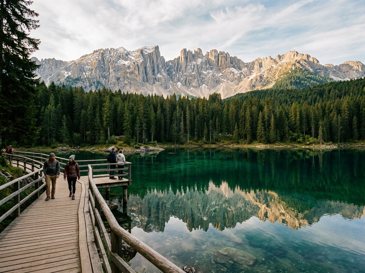
Early morning arrivals are rewarded with mirror-calm reflections of the Latemar needles in the turquoise water. A timber perimeter boardwalk preserves the fragile lakeshore flora. Continuing eastward, the road breaches Passo Costalunga (Karerpass) at 1,752 meters, crossing the linguistic border from German-speaking South Tyrol into the Ladin-speaking Val di Fassa in the Trentino province. Consult the South Tyrol Official Tourism Authority for seasonal road work schedules along the SS241 corridor.
Segment 2: Val di Fassa to the High Col of Passo Pordoi
Dropping gently into Vigo di Fassa and navigating north through Pozza and Canazei, the road begins its most celebrated ascent. Canazei sits in the shadow of the colossal Sella group, a fortress-like limestone plateau that dominates central Dolomite geography.
From Canazei to the crest of Passo Pordoi, the road climbs 774 vertical meters through 28 numbered switchbacks on the western ramp alone. Each hairpin turn is engineered with consistent radius geometry, allowing drivers to maintain steady momentum. As you climb above the subalpine spruce tree line, the colossal south wall of the Marmolada glacier appears across the Avisio valley, its glacial ice sheet glistening against the limestone crags.
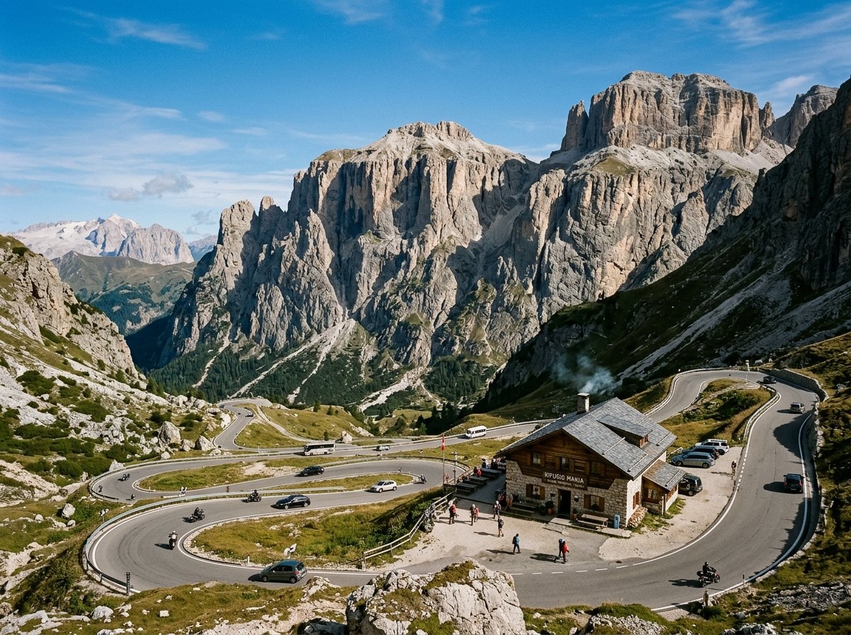
Passo Pordoi crowns the route at 2,239 meters (7,346 feet). At the summit col, travellers can board the Sass Pordoi cable car to reach 2,950 meters in under four minutes, stepping onto the “Terrace of the Dolomites” with 360-degree vistas extending to the Austrian Alps.
Field Advisory
Transmission & Engine Braking Rule
Waypoint Elevations & Navigational Data
The table below outlines the primary route checkpoints, elevations, and road designations across the 110-kilometer crossing:
| Waypoint | Elevation | Route | Highlights |
|---|---|---|---|
| Bolzano / Bozen | 262 m / 860 ft | SS241 Entry | Vineyard valleys, Tyrolean arcades |
| Lake Carezza (Karersee) | 1,520 m / 4,987 ft | SS241 | Turquoise water, Latemar reflection |
| Passo Costalunga | 1,752 m / 5,748 ft | SS241 | Rosengarten gateway col |
| Canazei | 1,450 m / 4,757 ft | SR48 | Ladin culture, Marmolada views |
| Passo Pordoi | 2,239 m / 7,346 ft | SR48 | 33 hairpins, Sella massif col |
| Arabba | 1,602 m / 5,256 ft | SR48 | Alpine hub, Livinallongo valley |
| Passo Falzarego | 2,105 m / 6,906 ft | SR48 | Lagazuoi cliffs, WWI open-air museum |
| Cortina d’Ampezzo | 1,224 m / 4,016 ft | SR48 Terminus | Boite valley basin, Cristallo range |
Segment 3: Passo Falzarego to Cortina d’Ampezzo
East of Arabba, the road skirts the green slopes of the Livinallongo valley before embarking on the ascent to Passo Falzarego (2,105 meters). The landscape here becomes starker, dotted with immense limestone boulders and scree slopes that witnessed bitter high-altitude mountain warfare during World War I.
At the summit of Falzarego, Mount Lagazuoi towers overhead. Hikers can explore preserved tunnel networks chiseled into the rock, while motorists enjoy sweeping views toward the Cinque Torri, five vertical limestone pillars that stand isolated on an alpine plateau. For alpine trail guidance and mountain hut safety protocols, review the resources published by the Club Alpino Italiano Mountain Safety.
The final descent from Falzarego into Cortina d’Ampezzo traverses dense larch and stone pine forests. As Cortina comes into view across the broad Boite basin, the jagged pink ramparts of Mount Cristallo and the Tofane provide an unforgettable amphitheater backdrop.
Rifugio Lagazuoi & Stargazer Pods
€185 / night
Driving Seasonality & Preparation Essentials
The optimal window for traversing the Great Dolomites Road spans from early June to mid-October. Outside this period, early autumn blizzards or lingering spring snowpacks frequently prompt temporary pass closures, particularly on Passo Pordoi.
- Vehicle Selection: While high-clearance four-wheel-drive vehicles are not required during dry summer months, compact to mid-size vehicles with precise steering and manual transmission options provide superior agility on tight hairpin corners.
- Cyclist Etiquette: The Grande Strada is a bucket-list climb for world cyclists. Exercise patience on blind corners, maintain at least 1.5 meters of passing clearance, and avoid overtaking on narrow uphill bends.
- Fuel & Charging: While filling stations are available in Bolzano, Canazei, and Cortina, mountain pass ascents increase fuel consumption by up to 40%. Enter the corridor with at least three-quarters of a tank or battery charge.
Whether driven in a single golden afternoon or savored over three days with overnight stops in mountain rifugios, the Great Dolomites Road stands as an enduring tribute to the romance of mountain discovery.
Continue planning your journey with our companion mountain pass dossiers, geodesic lodging inspections, and packing blueprints:
-
Swiss Alps Grand Tour Guide →
Furka, Grimsel, and high-altitude rail cols across the Swiss Alps. -
Swiss Alpine Stargazer Pods →
High-elevation geodesic timber sanctuaries in the Valais Alps. -
Mountain Road Trip Packing Blueprint →
Technical vehicle prep, offline topo navigation, and alpine weather layering.